
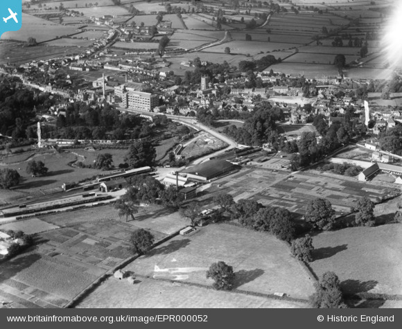
EPR000052 ENGLAND (1934). The town, Calne, 1934. This image has been affected by flare.
© Copyright OpenStreetMap contributors and licensed by the OpenStreetMap Foundation. 2026. Cartography is licensed as CC BY-SA.
Nearby Images (15)
EPR000052

EPR000051

EPR000054

EPR000050

EPW029301

EPR000049
 Ltd By-Products Factory at the railway station, Calne, 1934")
EPW033527

EPW033522

EPR000053

EPR000055

EPW029292

EPW029294

EPW001114

EPW029288

EPW029296

Details
| Title | [EPR000052] The town, Calne, 1934. This image has been affected by flare. |
| Reference | EPR000052 |
| Date | 2-July-1934 |
| Link | |
| Place name | CALNE |
| Parish | CALNE |
| District | |
| Country | ENGLAND |
| Easting / Northing | 399659, 170669 |
| Longitude / Latitude | -2.0049060881537, 51.434529469273 |
| National Grid Reference | ST997707 |
Pins
Be the first to add a comment to this image!