
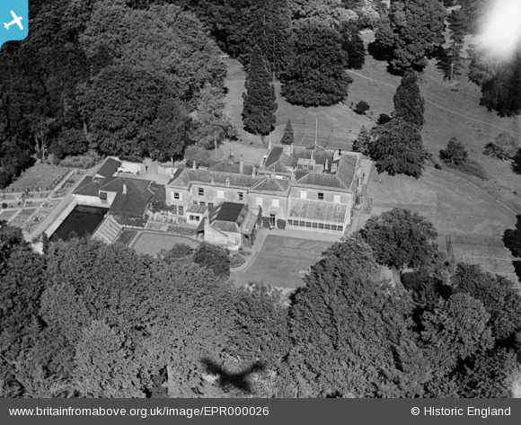
EPR000026 ENGLAND (1934). Kingwell Hall Preparatory School, Farmborough, 1934. This image has been affected by flare.
© Copyright OpenStreetMap contributors and licensed by the OpenStreetMap Foundation. 2025. Cartography is licensed as CC BY-SA.
Nearby Images (4)
EPR000026

EPR000024

EPR000025

EAW010774

Details
| Title | [EPR000026] Kingwell Hall Preparatory School, Farmborough, 1934. This image has been affected by flare. |
| Reference | EPR000026 |
| Date | 4-July-1934 |
| Link | |
| Place name | FARMBOROUGH |
| Parish | FARMBOROUGH |
| District | |
| Country | ENGLAND |
| Easting / Northing | 364780, 159262 |
| Longitude / Latitude | -2.5055805513289, 51.33085894084 |
| National Grid Reference | ST648593 |
Pins
Be the first to add a comment to this image!