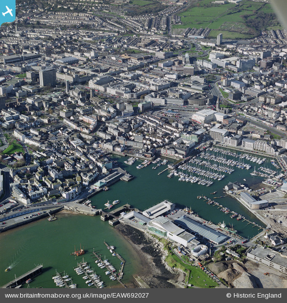
EAW692027 ENGLAND (2002). Sutton Harbour, Plymouth, 2002
© Copyright OpenStreetMap contributors and licensed by the OpenStreetMap Foundation. 2026. Cartography is licensed as CC BY-SA.
Details
| Title | [EAW692027] Sutton Harbour, Plymouth, 2002 |
| Reference | EAW692027 |
| Date | 14-February-2002 |
| Link | |
| Place name | PLYMOUTH |
| Parish | NON CIVIL PARISH |
| District | |
| Country | ENGLAND |
| Easting / Northing | 248289, 54315 |
| Longitude / Latitude | -4.1335329279946, 50.368539348523 |
| National Grid Reference | SX483543 |
Pins
Be the first to add a comment to this image!


![[EAW692027] Sutton Harbour, Plymouth, 2002](http://britainfromabove.org.uk/sites/all/libraries/aerofilms-images/public/100x100/EAW/692/EAW692027.jpg)
![[EPW054883] Sutton Harbour, Plymouth, 1937](http://britainfromabove.org.uk/sites/all/libraries/aerofilms-images/public/100x100/EPW/054/EPW054883.jpg)
![[EPW054891] The city centre, Plymouth, from the south-east, 1937](http://britainfromabove.org.uk/sites/all/libraries/aerofilms-images/public/100x100/EPW/054/EPW054891.jpg)