
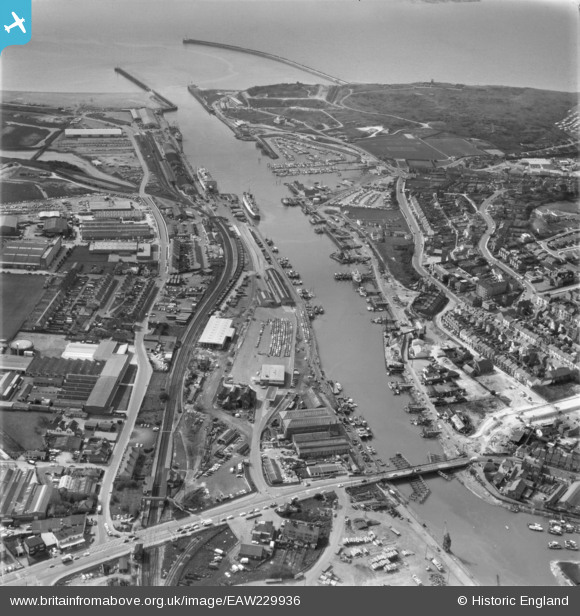
EAW229936 ENGLAND (1972). Newhaven Harbour and the River Ouse, Newhaven, 1972
© Copyright OpenStreetMap contributors and licensed by the OpenStreetMap Foundation. 2026. Cartography is licensed as CC BY-SA.
Nearby Images (4)
EAW229936

EAW028826

EAW028827

EPW011508

Details
| Title | [EAW229936] Newhaven Harbour and the River Ouse, Newhaven, 1972 |
| Reference | EAW229936 |
| Date | 28-April-1972 |
| Link | |
| Place name | NEWHAVEN |
| Parish | NEWHAVEN |
| District | |
| Country | ENGLAND |
| Easting / Northing | 544870, 101113 |
| Longitude / Latitude | 0.055629763064899, 50.790892769331 |
| National Grid Reference | TQ449011 |
Pins

lokash |
Saturday 28th of September 2024 09:15:08 AM | |
|
lokash |
Saturday 28th of September 2024 09:11:59 AM | |
|
lokash |
Saturday 28th of September 2024 09:11:33 AM | |
|
Kevin |
Monday 12th of June 2017 08:21:33 AM | |
|
Kevin |
Monday 12th of June 2017 08:16:09 AM | |
|
Brightonboy |
Friday 14th of October 2016 08:30:37 AM | |
|
Brightonboy |
Friday 14th of October 2016 08:25:57 AM | |
|
Brightonboy |
Friday 14th of October 2016 08:22:06 AM | |
|
Brightonboy |
Friday 14th of October 2016 08:20:01 AM | |
|
Brightonboy |
Friday 14th of October 2016 08:19:08 AM | |

bescotbeast |
Friday 14th of October 2016 02:11:30 AM | |

Billy Turner |
Thursday 15th of September 2016 06:46:13 PM | |
|
ken |
Monday 23rd of November 2015 03:40:45 PM | |
|
ken |
Monday 23rd of November 2015 12:03:59 PM |
