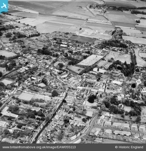
EAW055113 ENGLAND (1954). The town centre, Downham Market, 1954
© Copyright OpenStreetMap contributors and licensed by the OpenStreetMap Foundation. 2025. Cartography is licensed as CC BY-SA.
Nearby Images (9)
Details
| Title | [EAW055113] The town centre, Downham Market, 1954 |
| Reference | EAW055113 |
| Date | 15-May-1954 |
| Link | |
| Place name | DOWNHAM MARKET |
| Parish | DOWNHAM MARKET |
| District | |
| Country | ENGLAND |
| Easting / Northing | 561229, 303251 |
| Longitude / Latitude | 0.38106008454088, 52.602731509968 |
| National Grid Reference | TF612033 |
Pins

Wissey |
Saturday 20th of March 2021 05:12:52 PM | |

Wissey |
Thursday 18th of March 2021 04:35:55 PM | |

Wissey |
Thursday 18th of March 2021 04:33:24 PM | |

Wissey |
Thursday 18th of March 2021 04:30:10 PM | |

Wissey |
Thursday 18th of March 2021 04:26:20 PM | |

volvoRman |
Friday 6th of November 2015 09:08:21 PM | |

volvoRman |
Friday 6th of November 2015 09:08:20 PM |


![[EAW055113] The town centre, Downham Market, 1954](http://britainfromabove.org.uk/sites/all/libraries/aerofilms-images/public/100x100/EAW/055/EAW055113.jpg)
![[EAW031885] The town centre, Downham Market, 1950](http://britainfromabove.org.uk/sites/all/libraries/aerofilms-images/public/100x100/EAW/031/EAW031885.jpg)
![[EPW021517] The town centre, Downham Market, 1928](http://britainfromabove.org.uk/sites/all/libraries/aerofilms-images/public/100x100/EPW/021/EPW021517.jpg)
![[EPW021518] Cannon Square and environs, Downham Market, 1928](http://britainfromabove.org.uk/sites/all/libraries/aerofilms-images/public/100x100/EPW/021/EPW021518.jpg)
![[EAW031887] The town, Downham Market, 1950](http://britainfromabove.org.uk/sites/all/libraries/aerofilms-images/public/100x100/EAW/031/EAW031887.jpg)
![[EAW031886] The town, Downham Market, 1950](http://britainfromabove.org.uk/sites/all/libraries/aerofilms-images/public/100x100/EAW/031/EAW031886.jpg)
![[EPW021515] Church Road and environs, Downham Market, 1928](http://britainfromabove.org.uk/sites/all/libraries/aerofilms-images/public/100x100/EPW/021/EPW021515.jpg)
![[EAW031884] The town, Downham Market, 1950](http://britainfromabove.org.uk/sites/all/libraries/aerofilms-images/public/100x100/EAW/031/EAW031884.jpg)
![[EPW021463] The Town Centre, Downham Market, 1928](http://britainfromabove.org.uk/sites/all/libraries/aerofilms-images/public/100x100/EPW/021/EPW021463.jpg)