
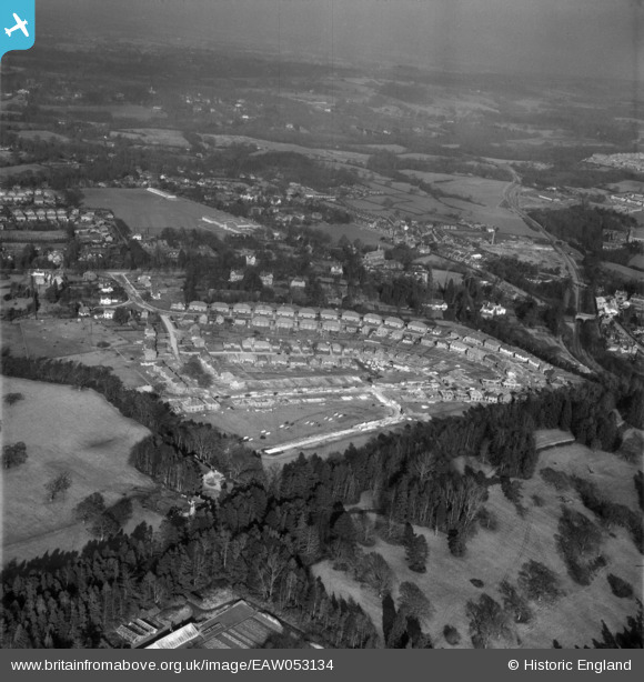
EAW053134 ENGLAND (1954). Housing under construction around Linden Avenue and environs, East Grinstead, from the south-west, 1954
© Copyright OpenStreetMap contributors and licensed by the OpenStreetMap Foundation. 2026. Cartography is licensed as CC BY-SA.
Nearby Images (7)
EAW053134

EAW053137

EAW053131

EAW053130

EAW053129

EAW053133

EAW053132A

Details
| Title | [EAW053134] Housing under construction around Linden Avenue and environs, East Grinstead, from the south-west, 1954 |
| Reference | EAW053134 |
| Date | 20-February-1954 |
| Link | |
| Place name | EAST GRINSTEAD |
| Parish | EAST GRINSTEAD |
| District | |
| Country | ENGLAND |
| Easting / Northing | 538273, 138558 |
| Longitude / Latitude | -0.023686262293628, 51.129060731171 |
| National Grid Reference | TQ383386 |
