
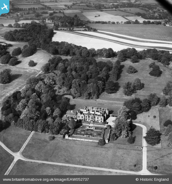
EAW052737 ENGLAND (1953). Chequers, Ellesborough, 1953
© Copyright OpenStreetMap contributors and licensed by the OpenStreetMap Foundation. 2025. Cartography is licensed as CC BY-SA.
Nearby Images (11)
EAW052737

EAW051605

EAW052739

EAW052740

EAW051604

EAW051607

EPR000039

EAW051603

EAW052738

EAW051602

EAW051606

Details
| Title | [EAW052737] Chequers, Ellesborough, 1953 |
| Reference | EAW052737 |
| Date | 9-October-1953 |
| Link | |
| Place name | ELLESBOROUGH |
| Parish | ELLESBOROUGH |
| District | |
| Country | ENGLAND |
| Easting / Northing | 484143, 205751 |
| Longitude / Latitude | -0.78113859607243, 51.743679715699 |
| National Grid Reference | SP841058 |
Pins
Be the first to add a comment to this image!