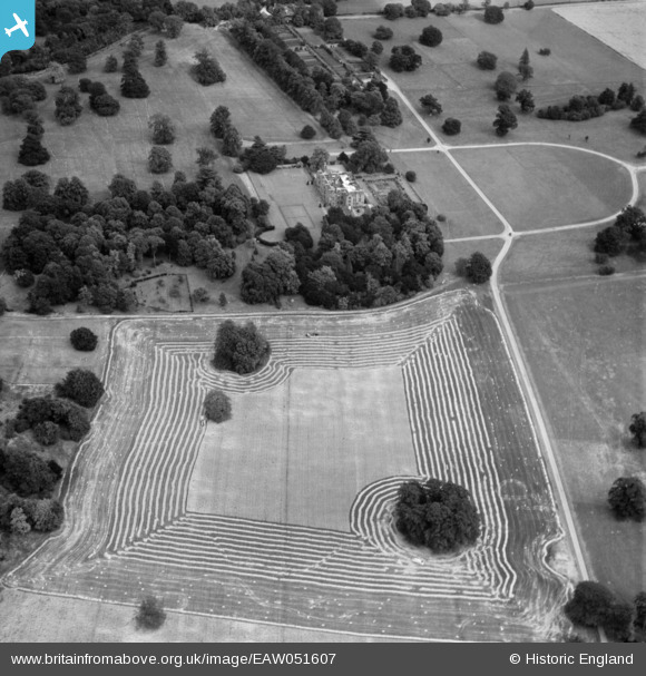
EAW051607 ENGLAND (1953). Chequers, Ellesborough, 1953
© Copyright OpenStreetMap contributors and licensed by the OpenStreetMap Foundation. 2025. Cartography is licensed as CC BY-SA.
Nearby Images (10)
Details
| Title | [EAW051607] Chequers, Ellesborough, 1953 |
| Reference | EAW051607 |
| Date | 26-August-1953 |
| Link | |
| Place name | ELLESBOROUGH |
| Parish | ELLESBOROUGH |
| District | |
| Country | ENGLAND |
| Easting / Northing | 484029, 205709 |
| Longitude / Latitude | -0.78279970000756, 51.743319242574 |
| National Grid Reference | SP840057 |
Pins
Be the first to add a comment to this image!


![[EAW051607] Chequers, Ellesborough, 1953](http://britainfromabove.org.uk/sites/all/libraries/aerofilms-images/public/100x100/EAW/051/EAW051607.jpg)
![[EAW051604] Chequers, Ellesborough, 1953](http://britainfromabove.org.uk/sites/all/libraries/aerofilms-images/public/100x100/EAW/051/EAW051604.jpg)
![[EAW052737] Chequers, Ellesborough, 1953](http://britainfromabove.org.uk/sites/all/libraries/aerofilms-images/public/100x100/EAW/052/EAW052737.jpg)
![[EAW051603] Chequers, Ellesborough, 1953](http://britainfromabove.org.uk/sites/all/libraries/aerofilms-images/public/100x100/EAW/051/EAW051603.jpg)
![[EAW052739] Chequers, Ellesborough, 1953](http://britainfromabove.org.uk/sites/all/libraries/aerofilms-images/public/100x100/EAW/052/EAW052739.jpg)
![[EAW051605] Chequers, Ellesborough, 1953](http://britainfromabove.org.uk/sites/all/libraries/aerofilms-images/public/100x100/EAW/051/EAW051605.jpg)
![[EAW052740] Chequers, Ellesborough, 1953](http://britainfromabove.org.uk/sites/all/libraries/aerofilms-images/public/100x100/EAW/052/EAW052740.jpg)
![[EPR000039] Chequers, Ellesborough, 1934](http://britainfromabove.org.uk/sites/all/libraries/aerofilms-images/public/100x100/EPR/000/EPR000039.jpg)
![[EAW052738] Chequers, Ellesborough, from the south-east, 1953](http://britainfromabove.org.uk/sites/all/libraries/aerofilms-images/public/100x100/EAW/052/EAW052738.jpg)
![[EAW051602] Chequers, Ellesborough, 1953](http://britainfromabove.org.uk/sites/all/libraries/aerofilms-images/public/100x100/EAW/051/EAW051602.jpg)