
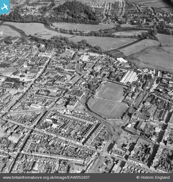
EAW051837 ENGLAND (1953). James Street Junction, Uxbridge Street and environs, Burton upon Trent, 1953
© Copyright OpenStreetMap contributors and licensed by the OpenStreetMap Foundation. 2026. Cartography is licensed as CC BY-SA.
Nearby Images (4)
EAW051837

EPW019725

EPW019721

EAW044095

Details
| Title | [EAW051837] James Street Junction, Uxbridge Street and environs, Burton upon Trent, 1953 |
| Reference | EAW051837 |
| Date | 1-September-1953 |
| Link | |
| Place name | BURTON UPON TRENT |
| Parish | BURTON |
| District | |
| Country | ENGLAND |
| Easting / Northing | 424694, 322533 |
| Longitude / Latitude | -1.6336978829444, 52.799458881645 |
| National Grid Reference | SK247225 |
Pins

Helen |
Thursday 30th of April 2026 08:19:56 PM | |
|
Helen |
Thursday 30th of April 2026 08:19:36 PM | |
|
Helen |
Thursday 30th of April 2026 08:18:39 PM | |
|
Helen |
Thursday 30th of April 2026 08:15:30 PM | |
|
Helen |
Thursday 30th of April 2026 08:14:23 PM | |
|
Helen |
Thursday 30th of April 2026 08:13:12 PM | |
|
Helen |
Thursday 30th of April 2026 07:55:52 PM | |

Matt Aldred edob.mattaldred.com |
Monday 11th of March 2024 06:44:03 PM | |
|
Matt Aldred edob.mattaldred.com |
Friday 9th of April 2021 10:32:53 PM | |
|
gBr |
Thursday 3rd of September 2015 07:23:35 PM | |
|
BGP |
Wednesday 12th of November 2014 12:26:09 PM | |
|
BGP |
Wednesday 12th of November 2014 12:25:33 PM | |
|
BGP |
Wednesday 12th of November 2014 12:20:58 PM |