
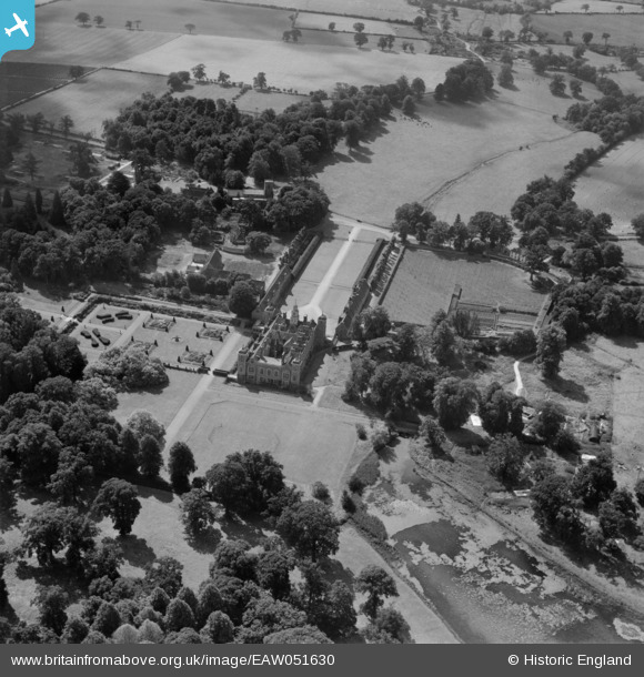
EAW051630 ENGLAND (1953). Blickling Hall, Blickling, 1953
© Copyright OpenStreetMap contributors and licensed by the OpenStreetMap Foundation. 2026. Cartography is licensed as CC BY-SA.
Nearby Images (17)
EAW051630

EAW018541

EPW021296A

EPW039268

EPW039266

EAW051632

EAW051629

EAW018540

EAW051633

EAW018542

EPW039265

EAW051634

EAW018543

EAW018545

EAW051631

EPW039267

EPW039264

Details
| Title | [EAW051630] Blickling Hall, Blickling, 1953 |
| Reference | EAW051630 |
| Date | 26-August-1953 |
| Link | |
| Place name | BLICKLING |
| Parish | BLICKLING |
| District | |
| Country | ENGLAND |
| Easting / Northing | 617867, 328679 |
| Longitude / Latitude | 1.2330911102583, 52.811233684324 |
| National Grid Reference | TG179287 |
Pins

Graham Yaxley |
Sunday 18th of January 2015 12:07:55 AM | |
|
Graham Yaxley |
Sunday 18th of January 2015 12:06:31 AM |