
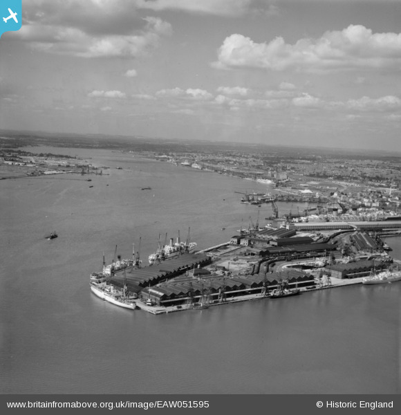
EAW051595 ENGLAND (1953). Southampton Docks and the River Test, Southampton, from the south-east, 1953
© Copyright OpenStreetMap contributors and licensed by the OpenStreetMap Foundation. 2026. Cartography is licensed as CC BY-SA.
Nearby Images (15)
EAW051595

EAW033431

EAW051596

EPW009068

EPW039726

EAW033430

EAW033409

EAW035242

EAW033408

EPW020456

EAW008807

EPW041068

EPW009066

EPW041071

EPW009064

Details
| Title | [EAW051595] Southampton Docks and the River Test, Southampton, from the south-east, 1953 |
| Reference | EAW051595 |
| Date | 26-August-1953 |
| Link | |
| Place name | SOUTHAMPTON |
| Parish | |
| District | |
| Country | ENGLAND |
| Easting / Northing | 442779, 109531 |
| Longitude / Latitude | -1.391814354091, 50.883129370055 |
| National Grid Reference | SU428095 |
Pins

The Laird |
Monday 23rd of April 2018 01:06:23 PM | |
|
The Laird |
Monday 23rd of April 2018 01:04:45 PM | |
|
The Laird |
Monday 23rd of April 2018 12:28:00 PM | |
|
chainbull |
Monday 16th of February 2015 04:41:48 PM |