
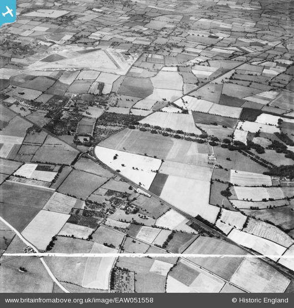
EAW051558 ENGLAND (1953). Cheddington station and village and surrounding countryside, Cheddington, 1953. This image was marked by Aerofilms Ltd for photo editing.
© Copyright OpenStreetMap contributors and licensed by the OpenStreetMap Foundation. 2026. Cartography is licensed as CC BY-SA.
Nearby Images (2)
EAW051558

EAW051555

Details
| Title | [EAW051558] Cheddington station and village and surrounding countryside, Cheddington, 1953. This image was marked by Aerofilms Ltd for photo editing. |
| Reference | EAW051558 |
| Date | 14-August-1953 |
| Link | |
| Place name | CHEDDINGTON |
| Parish | CHEDDINGTON |
| District | |
| Country | ENGLAND |
| Easting / Northing | 491731, 218555 |
| Longitude / Latitude | -0.66786406791407, 51.857591739189 |
| National Grid Reference | SP917186 |
