
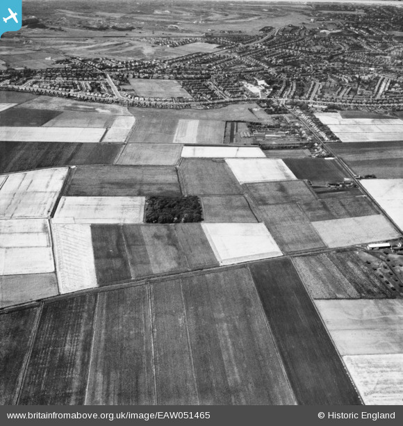
EAW051465 ENGLAND (1953). Fields around King's Covert and the outskirts of Southport, Halsall Moss, 1953
© Copyright OpenStreetMap contributors and licensed by the OpenStreetMap Foundation. 2025. Cartography is licensed as CC BY-SA.
Nearby Images (7)
EAW051465

EAW051460

EAW051461

EAW051462

EAW051459

EAW051464

EAW051463

Details
| Title | [EAW051465] Fields around King's Covert and the outskirts of Southport, Halsall Moss, 1953 |
| Reference | EAW051465 |
| Date | 12-August-1953 |
| Link | |
| Place name | HALSALL MOSS |
| Parish | HALSALL |
| District | |
| Country | ENGLAND |
| Easting / Northing | 333724, 412968 |
| Longitude / Latitude | -3.0018268755601, 53.608833204123 |
| National Grid Reference | SD337130 |
Pins

martinmj |
Monday 11th of July 2022 09:21:26 PM | |
|
Davefenna |
Friday 9th of January 2015 08:59:32 AM | |
|
Davefenna |
Friday 9th of January 2015 08:58:28 AM | |
|
Davefenna |
Friday 9th of January 2015 08:54:24 AM |