
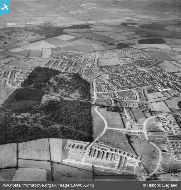
EAW051443 ENGLAND (1953). Housing development around Hazel and Thoroughsale Woods, Corby, 1953
© Copyright OpenStreetMap contributors and licensed by the OpenStreetMap Foundation. 2026. Cartography is licensed as CC BY-SA.
Nearby Images (3)
EAW051443

EAW045433

EAW051448

Details
| Title | [EAW051443] Housing development around Hazel and Thoroughsale Woods, Corby, 1953 |
| Reference | EAW051443 |
| Date | 12-August-1953 |
| Link | |
| Place name | CORBY |
| Parish | |
| District | |
| Country | ENGLAND |
| Easting / Northing | 487910, 289145 |
| Longitude / Latitude | -0.70503886001656, 52.492754948536 |
| National Grid Reference | SP879891 |
Pins
Be the first to add a comment to this image!