
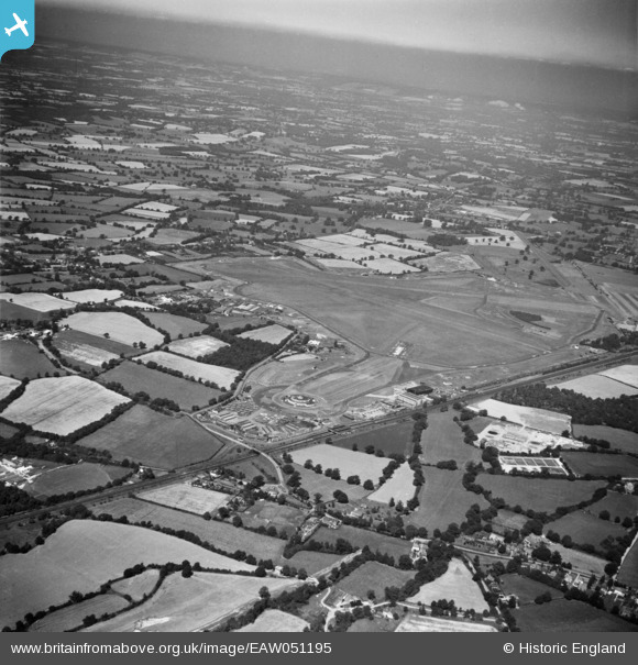
EAW051195 ENGLAND (1953). The Beehive terminal building and Gatwick Airport, Crawley, from the south-east, 1953
© Copyright OpenStreetMap contributors and licensed by the OpenStreetMap Foundation. 2026. Cartography is licensed as CC BY-SA.
Nearby Images (6)
EAW051195

EPW053260

EAW050734
, Crawley, 1953")
EPW053265

EAW050736
, Crawley, 1953")
EAW050735
, Crawley, 1953")
Details
| Title | [EAW051195] The Beehive terminal building and Gatwick Airport, Crawley, from the south-east, 1953 |
| Reference | EAW051195 |
| Date | 6-August-1953 |
| Link | |
| Place name | CRAWLEY |
| Parish | |
| District | |
| Country | ENGLAND |
| Easting / Northing | 528873, 139698 |
| Longitude / Latitude | -0.157553940077, 51.141500222454 |
| National Grid Reference | TQ289397 |
Pins

cptpies |
Monday 7th of January 2019 10:44:23 AM |
User Comment Contributions
Gatwick Airport |

Alan McFaden |
Friday 14th of November 2014 10:25:46 AM |