
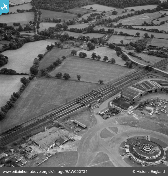
EAW050734 ENGLAND (1953). The railway station near The Beehive (Gatwick Airport South), Crawley, 1953
© Copyright OpenStreetMap contributors and licensed by the OpenStreetMap Foundation. 2026. Cartography is licensed as CC BY-SA.
Nearby Images (7)
EAW050734
, Crawley, 1953")
EPW053265

EAW050736
, Crawley, 1953")
EAW051195

EAW050735
, Crawley, 1953")
EPW053260

EPW053263

Details
| Title | [EAW050734] The railway station near The Beehive (Gatwick Airport South), Crawley, 1953 |
| Reference | EAW050734 |
| Date | 15-July-1953 |
| Link | |
| Place name | CRAWLEY |
| Parish | |
| District | |
| Country | ENGLAND |
| Easting / Northing | 528839, 139865 |
| Longitude / Latitude | -0.15797999624656, 51.143008940331 |
| National Grid Reference | TQ288399 |
Pins

ken |
Monday 10th of August 2015 03:35:44 PM | |
|
ken |
Monday 10th of August 2015 03:34:19 PM | |
|
tholl17 |
Tuesday 7th of October 2014 07:00:30 PM | |
|
tholl17 |
Tuesday 7th of October 2014 06:59:45 PM | |
|
MB |
Monday 6th of October 2014 05:11:32 PM | |
|
MB |
Monday 6th of October 2014 05:10:33 PM |
User Comment Contributions

Gatwick Airport |

Alan McFaden |
Saturday 27th of September 2014 10:44:07 AM |