
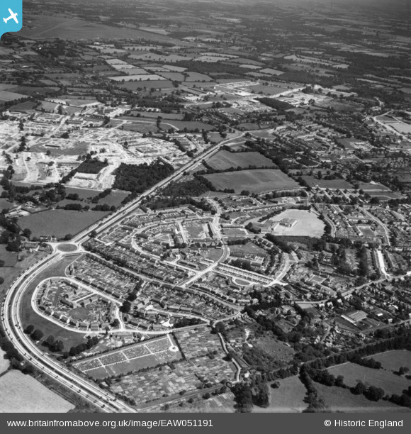
EAW051191 ENGLAND (1953). West Green and the Crawley Bypass, Crawley, 1953. This image has been produced from a print.
© Copyright OpenStreetMap contributors and licensed by the OpenStreetMap Foundation. 2026. Cartography is licensed as CC BY-SA.
Nearby Images (3)
EAW051191

EAW041926

EAW037053

Details
| Title | [EAW051191] West Green and the Crawley Bypass, Crawley, 1953. This image has been produced from a print. |
| Reference | EAW051191 |
| Date | 6-August-1953 |
| Link | |
| Place name | CRAWLEY |
| Parish | |
| District | |
| Country | ENGLAND |
| Easting / Northing | 526207, 137236 |
| Longitude / Latitude | -0.19651066878111, 51.119964308377 |
| National Grid Reference | TQ262372 |
Pins

M Anton |
Tuesday 29th of May 2018 02:51:12 PM | |
|
M Anton |
Tuesday 29th of May 2018 02:48:37 PM | |
|
M Anton |
Tuesday 29th of May 2018 02:45:21 PM | |
|
M Anton |
Tuesday 29th of May 2018 02:42:11 PM |