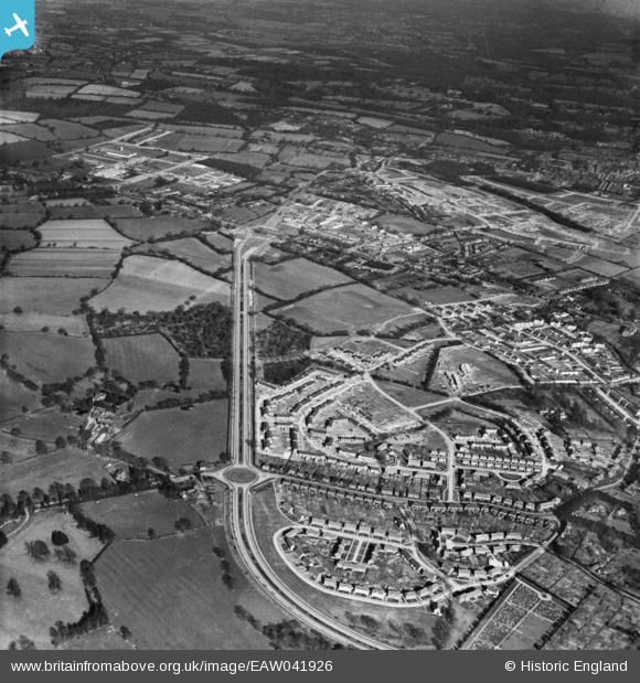
EAW041926 ENGLAND (1952). Crawley by-pass and the construction of new neighbourhoods at West Green and Northgate, West Green, 1952
© Copyright OpenStreetMap contributors and licensed by the OpenStreetMap Foundation. 2026. Cartography is licensed as CC BY-SA.
Details
| Title | [EAW041926] Crawley by-pass and the construction of new neighbourhoods at West Green and Northgate, West Green, 1952 |
| Reference | EAW041926 |
| Date | 14-March-1952 |
| Link | |
| Place name | WEST GREEN |
| Parish | |
| District | |
| Country | ENGLAND |
| Easting / Northing | 526373, 137334 |
| Longitude / Latitude | -0.19410544752879, 51.12080859499 |
| National Grid Reference | TQ264373 |
Pins

Class31 |
Wednesday 30th of July 2014 07:23:49 PM | |

Class31 |
Wednesday 30th of July 2014 07:21:52 PM | |

Class31 |
Wednesday 30th of July 2014 07:20:34 PM | |

Class31 |
Wednesday 30th of July 2014 07:17:48 PM | |

Class31 |
Wednesday 30th of July 2014 07:17:32 PM | |

Class31 |
Wednesday 30th of July 2014 07:15:53 PM |


![[EAW041926] Crawley by-pass and the construction of new neighbourhoods at West Green and Northgate, West Green, 1952](http://britainfromabove.org.uk/sites/all/libraries/aerofilms-images/public/100x100/EAW/041/EAW041926.jpg)
![[EAW051191] West Green and the Crawley Bypass, Crawley, 1953. This image has been produced from a print.](http://britainfromabove.org.uk/sites/all/libraries/aerofilms-images/public/100x100/EAW/051/EAW051191.jpg)