
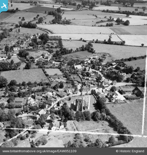
EAW051109 ENGLAND (1953). St Mary's Church and the village, Steeple Bumpstead, 1953. This image was marked by Aerofilms Ltd for photo editing.
© Copyright OpenStreetMap contributors and licensed by the OpenStreetMap Foundation. 2026. Cartography is licensed as CC BY-SA.
Nearby Images (3)
EAW051109

EAW048833

EAW051110

Details
| Title | [EAW051109] St Mary's Church and the village, Steeple Bumpstead, 1953. This image was marked by Aerofilms Ltd for photo editing. |
| Reference | EAW051109 |
| Date | 10-August-1953 |
| Link | |
| Place name | STEEPLE BUMPSTEAD |
| Parish | STEEPLE BUMPSTEAD |
| District | |
| Country | ENGLAND |
| Easting / Northing | 568016, 241137 |
| Longitude / Latitude | 0.45015830783845, 52.04271026002 |
| National Grid Reference | TL680411 |
Pins
Be the first to add a comment to this image!