
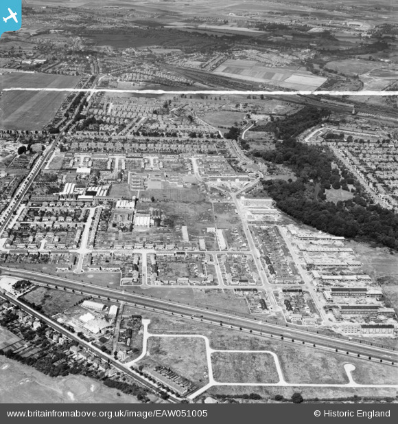
EAW051005 ENGLAND (1953). The Butts Farm Estate and environs, Hanworth, 1953. This image was marked by Aerofilms Ltd for photo editing.
© Copyright OpenStreetMap contributors and licensed by the OpenStreetMap Foundation. 2026. Cartography is licensed as CC BY-SA.
Nearby Images (13)
EAW051005

EAW051552

EAW051002

EAW051006

EAW051546

EAW051009

EAW051549

EAW051548

EAW051003

EAW051545

EAW051547

EAW051007

EAW051004

Details
| Title | [EAW051005] The Butts Farm Estate and environs, Hanworth, 1953. This image was marked by Aerofilms Ltd for photo editing. |
| Reference | EAW051005 |
| Date | 3-August-1953 |
| Link | |
| Place name | HANWORTH |
| Parish | |
| District | |
| Country | ENGLAND |
| Easting / Northing | 512697, 172597 |
| Longitude / Latitude | -0.37832339537528, 51.440651070674 |
| National Grid Reference | TQ127726 |
