
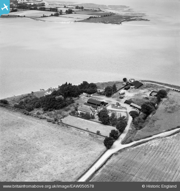
EAW050578 ENGLAND (1953). Stansgate Abbey Farm on the site of Stansgate Priory, Steeple, 1953
© Copyright OpenStreetMap contributors and licensed by the OpenStreetMap Foundation. 2026. Cartography is licensed as CC BY-SA.
Nearby Images (2)
EAW050578

EAW050577

Details
| Title | [EAW050578] Stansgate Abbey Farm on the site of Stansgate Priory, Steeple, 1953 |
| Reference | EAW050578 |
| Date | 10-July-1953 |
| Link | |
| Place name | STEEPLE |
| Parish | STEEPLE |
| District | |
| Country | ENGLAND |
| Easting / Northing | 593051, 205741 |
| Longitude / Latitude | 0.79499970361126, 51.716661993768 |
| National Grid Reference | TL931057 |
Pins

Matt Aldred edob.mattaldred.com |
Tuesday 22nd of April 2025 10:09:42 AM |