
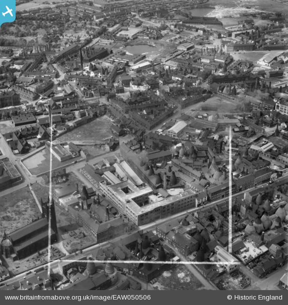
EAW050506 ENGLAND (1953). The Taylor Tunnicliff & Co Ltd Works on Normacot Road and environs, Longton, 1953. This image was marked by Aerofilms Ltd for photo editing.
© Copyright OpenStreetMap contributors and licensed by the OpenStreetMap Foundation. 2026. Cartography is licensed as CC BY-SA.
Nearby Images (17)
EAW050506

EAW050499

EAW050504

EAW050507

EAW050502

EAW050501

EAW050505

EAW050500

EAW050498

EPW054096

EPR000430

EAW013142

EAW018065

EAW018073

EAW018066

EAW018064

EAW018068

Details
| Title | [EAW050506] The Taylor Tunnicliff & Co Ltd Works on Normacot Road and environs, Longton, 1953. This image was marked by Aerofilms Ltd for photo editing. |
| Reference | EAW050506 |
| Date | 8-July-1953 |
| Link | |
| Place name | LONGTON |
| Parish | |
| District | |
| Country | ENGLAND |
| Easting / Northing | 391242, 343157 |
| Longitude / Latitude | -2.1304699391482, 52.985370182631 |
| National Grid Reference | SJ912432 |
Pins

SH |
Wednesday 13th of January 2021 04:16:30 AM |