
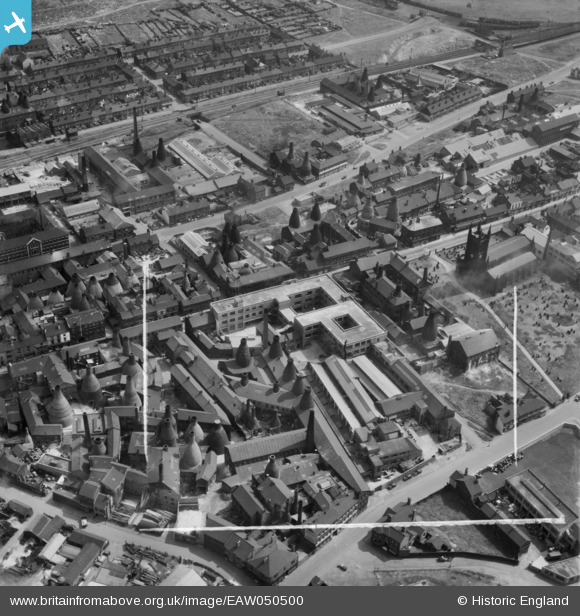
EAW050500 ENGLAND (1953). The Taylor Tunnicliff & Co Ltd Works on Normacot Road and environs, Longton, 1953. This image was marked by Aerofilms Ltd for photo editing.
© Copyright OpenStreetMap contributors and licensed by the OpenStreetMap Foundation. 2026. Cartography is licensed as CC BY-SA.
Nearby Images (18)
EAW050500

EAW050505

EAW050501

EAW050502

EAW050499

EAW050507

EAW050504

EAW050506

EAW050498

EPW054096

EAW008575

EAW008578

EAW008577

EAW008583

EAW008319

EAW008580

EAW008581

EAW008579

Details
| Title | [EAW050500] The Taylor Tunnicliff & Co Ltd Works on Normacot Road and environs, Longton, 1953. This image was marked by Aerofilms Ltd for photo editing. |
| Reference | EAW050500 |
| Date | 8-July-1953 |
| Link | |
| Place name | LONGTON |
| Parish | |
| District | |
| Country | ENGLAND |
| Easting / Northing | 391360, 343208 |
| Longitude / Latitude | -2.128713433736, 52.985830599567 |
| National Grid Reference | SJ914432 |
