
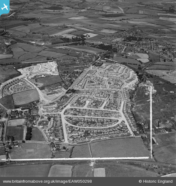
EAW050298 ENGLAND (1953). Council estate at Chickenley, Dewsbury, 1953. This image was marked by Aerofilms Ltd for photo editing.
© Copyright OpenStreetMap contributors and licensed by the OpenStreetMap Foundation. 2026. Cartography is licensed as CC BY-SA.
Nearby Images (8)
EAW050298

EAW050294

EAW050297

EAW050299

EAW050295

EAW050301

EAW050307

EAW050308

Details
| Title | [EAW050298] Council estate at Chickenley, Dewsbury, 1953. This image was marked by Aerofilms Ltd for photo editing. |
| Reference | EAW050298 |
| Date | 3-July-1953 |
| Link | |
| Place name | DEWSBURY |
| Parish | |
| District | |
| Country | ENGLAND |
| Easting / Northing | 426587, 421305 |
| Longitude / Latitude | -1.5973697299478, 53.687292831434 |
| National Grid Reference | SE266213 |


