
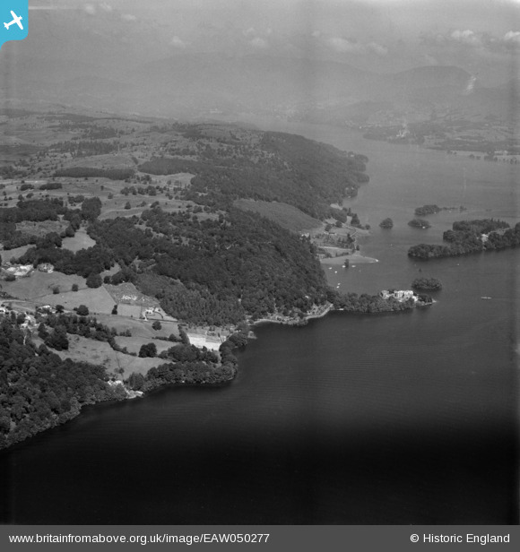
EAW050277 ENGLAND (1953). Station Scar Wood and environs, Far Sawrey, from the south, 1953
© Copyright OpenStreetMap contributors and licensed by the OpenStreetMap Foundation. 2026. Cartography is licensed as CC BY-SA.
Nearby Images (3)
EAW050277

EAW050280

EAW050272

Details
| Title | [EAW050277] Station Scar Wood and environs, Far Sawrey, from the south, 1953 |
| Reference | EAW050277 |
| Date | 29-June-1953 |
| Link | |
| Place name | FAR SAWREY |
| Parish | CLAIFE |
| District | |
| Country | ENGLAND |
| Easting / Northing | 338811, 495386 |
| Longitude / Latitude | -2.9415002832815, 54.350187798339 |
| National Grid Reference | SD388954 |
Pins
Be the first to add a comment to this image!