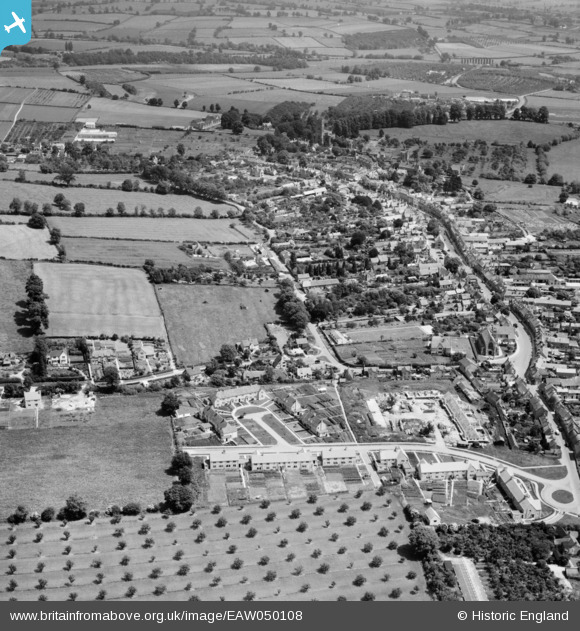
EAW050108 ENGLAND (1953). The town, Chipping Campden, 1953
© Copyright OpenStreetMap contributors and licensed by the OpenStreetMap Foundation. 2025. Cartography is licensed as CC BY-SA.
Nearby Images (9)
Details
| Title | [EAW050108] The town, Chipping Campden, 1953 |
| Reference | EAW050108 |
| Date | 26-June-1953 |
| Link | |
| Place name | CHIPPING CAMPDEN |
| Parish | CHIPPING CAMPDEN |
| District | |
| Country | ENGLAND |
| Easting / Northing | 414858, 239179 |
| Longitude / Latitude | -1.7833062702538, 52.050381521719 |
| National Grid Reference | SP149392 |
Pins
Be the first to add a comment to this image!


![[EAW050108] The town, Chipping Campden, 1953](http://britainfromabove.org.uk/sites/all/libraries/aerofilms-images/public/100x100/EAW/050/EAW050108.jpg)
![[EAW001657] The town, Chipping Campden, from the south-west, 1946](http://britainfromabove.org.uk/sites/all/libraries/aerofilms-images/public/100x100/EAW/001/EAW001657.jpg)
![[EAW001659] The Market Place and environs, Chipping Campden, 1946](http://britainfromabove.org.uk/sites/all/libraries/aerofilms-images/public/100x100/EAW/001/EAW001659.jpg)
![[EPW026863] The town centre, Chipping Campden, 1929](http://britainfromabove.org.uk/sites/all/libraries/aerofilms-images/public/100x100/EPW/026/EPW026863.jpg)
![[EPW026876] The town centre, Chipping Campden, 1929](http://britainfromabove.org.uk/sites/all/libraries/aerofilms-images/public/100x100/EPW/026/EPW026876.jpg)
![[EAW050106] The town, Chipping Campden, 1953](http://britainfromabove.org.uk/sites/all/libraries/aerofilms-images/public/100x100/EAW/050/EAW050106.jpg)
![[EPW026865] St Mary's RC Church and the High Street, Chipping Campden, 1929](http://britainfromabove.org.uk/sites/all/libraries/aerofilms-images/public/100x100/EPW/026/EPW026865.jpg)
![[EPW026868] The town centre, Chipping Campden, 1929](http://britainfromabove.org.uk/sites/all/libraries/aerofilms-images/public/100x100/EPW/026/EPW026868.jpg)
![[EAW001656] Westington and Littleworth, Chipping Campden, 1946](http://britainfromabove.org.uk/sites/all/libraries/aerofilms-images/public/100x100/EAW/001/EAW001656.jpg)