
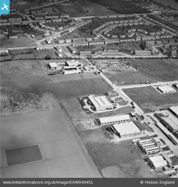
EAW049451 ENGLAND (1953). Industrial buildings along Roebuck Road, Hainault, 1953
© Copyright OpenStreetMap contributors and licensed by the OpenStreetMap Foundation. 2026. Cartography is licensed as CC BY-SA.
Nearby Images (8)
EAW049451

EAW049457

EAW049454

EAW049456A

EAW049453

EAW049452

EAW049456

EAW049455

Details
| Title | [EAW049451] Industrial buildings along Roebuck Road, Hainault, 1953 |
| Reference | EAW049451 |
| Date | 19-May-1953 |
| Link | |
| Place name | HAINAULT |
| Parish | |
| District | |
| Country | ENGLAND |
| Easting / Northing | 546855, 191913 |
| Longitude / Latitude | 0.12093367915887, 51.606404848028 |
| National Grid Reference | TQ469919 |
Pins

Ferrers |
Saturday 26th of November 2022 12:26:45 PM | |

Mango |
Thursday 22nd of June 2017 08:13:12 PM | |
|
brian |
Friday 5th of December 2014 01:54:19 PM |