
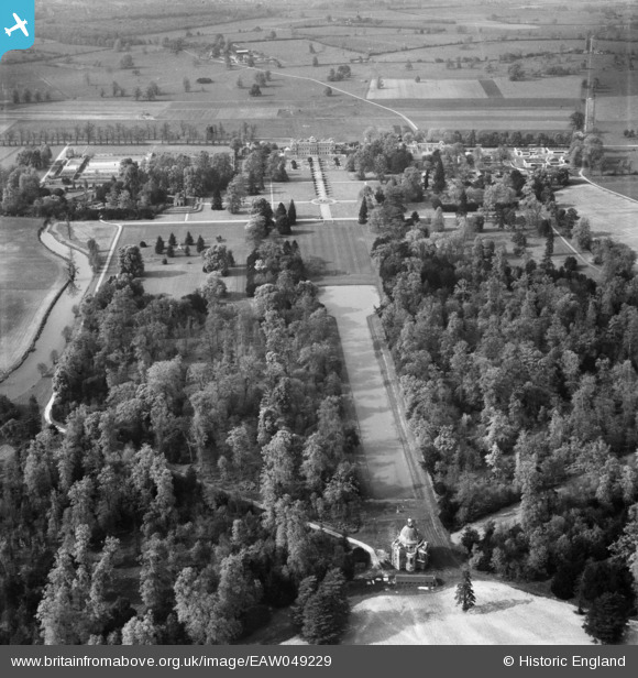
EAW049229 ENGLAND (1953). Wrest House, the Long Canal and Pavilion, Wrest Park, 1953
© Copyright OpenStreetMap contributors and licensed by the OpenStreetMap Foundation. 2025. Cartography is licensed as CC BY-SA.
Nearby Images (3)
EAW049229

EAW024082

EAW024083

Details
| Title | [EAW049229] Wrest House, the Long Canal and Pavilion, Wrest Park, 1953 |
| Reference | EAW049229 |
| Date | 11-May-1953 |
| Link | |
| Place name | WREST PARK |
| Parish | SILSOE |
| District | |
| Country | ENGLAND |
| Easting / Northing | 509124, 235039 |
| Longitude / Latitude | -0.4101473421607, 52.002626003632 |
| National Grid Reference | TL091350 |
