
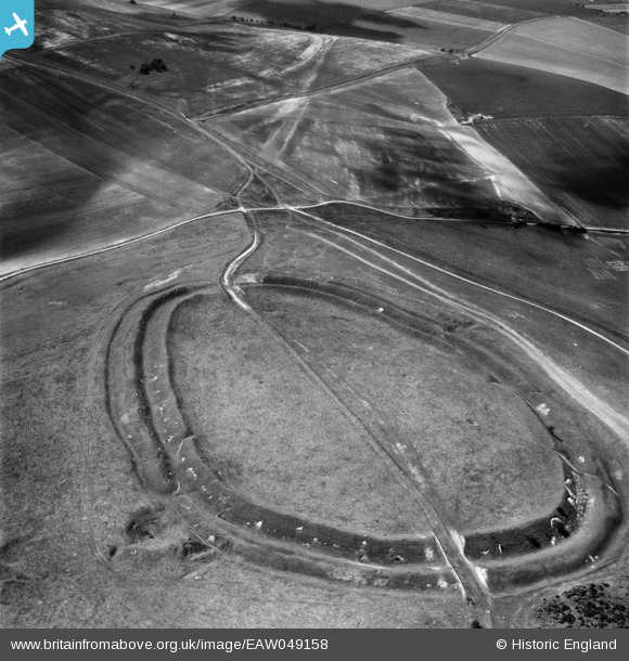
EAW049158 ENGLAND (1953). Barbury Castle, Wroughton, 1953
© Copyright OpenStreetMap contributors and licensed by the OpenStreetMap Foundation. 2026. Cartography is licensed as CC BY-SA.
Nearby Images (6)
EAW049158

EAW049159

EAW049160

EAW007061

EAW007060

EAW007059

Details
| Title | [EAW049158] Barbury Castle, Wroughton, 1953 |
| Reference | EAW049158 |
| Date | 5-May-1953 |
| Link | |
| Place name | WROUGHTON |
| Parish | WROUGHTON |
| District | |
| Country | ENGLAND |
| Easting / Northing | 414821, 176304 |
| Longitude / Latitude | -1.7865295415787, 51.485008429596 |
| National Grid Reference | SU148763 |
Pins
Be the first to add a comment to this image!