
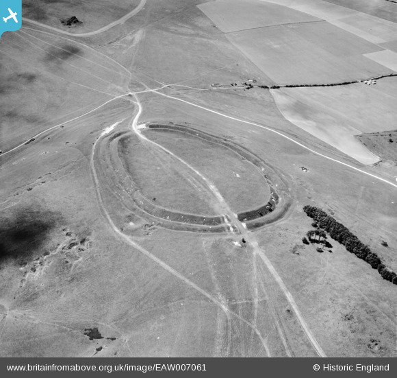
EAW007061 ENGLAND (1947). Barbury Castle, Ogbourne St Andrew, 1947
© Copyright OpenStreetMap contributors and licensed by the OpenStreetMap Foundation. 2026. Cartography is licensed as CC BY-SA.
Nearby Images (6)
EAW007061

EAW049160

EAW049159

EAW049158

EAW007060

EAW007059

Details
| Title | [EAW007061] Barbury Castle, Ogbourne St Andrew, 1947 |
| Reference | EAW007061 |
| Date | 11-June-1947 |
| Link | |
| Place name | OGBOURNE ST ANDREW |
| Parish | OGBOURNE ST. ANDREW |
| District | |
| Country | ENGLAND |
| Easting / Northing | 414970, 176273 |
| Longitude / Latitude | -1.7843847894065, 51.484725737461 |
| National Grid Reference | SU150763 |
Pins
Be the first to add a comment to this image!