
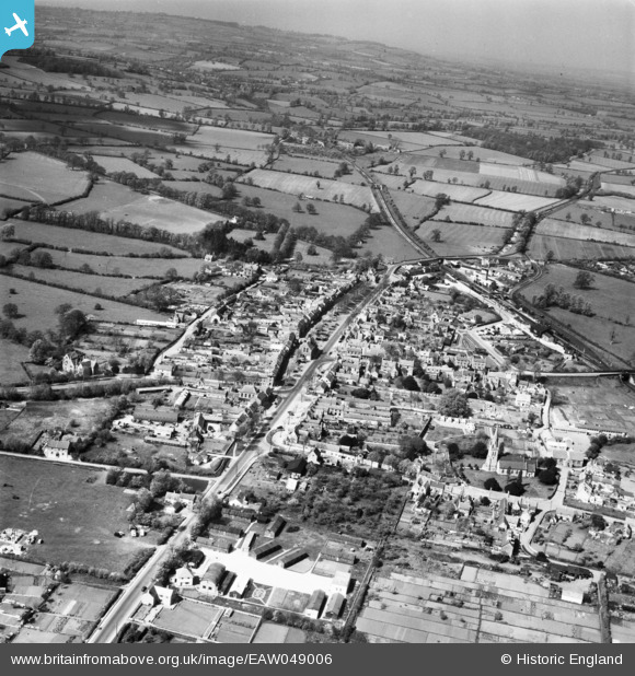
EAW049006 ENGLAND (1953). The town, Moreton-in-Marsh, from the south, 1953
© Copyright OpenStreetMap contributors and licensed by the OpenStreetMap Foundation. 2026. Cartography is licensed as CC BY-SA.
Nearby Images (5)
EAW049006

EPW026885

EPW026881

EPW026884

EAW049005

Details
| Title | [EAW049006] The town, Moreton-in-Marsh, from the south, 1953 |
| Reference | EAW049006 |
| Date | 5-May-1953 |
| Link | |
| Place name | MORETON-IN-MARSH |
| Parish | MORETON-IN-MARSH |
| District | |
| Country | ENGLAND |
| Easting / Northing | 420498, 232154 |
| Longitude / Latitude | -1.701472544827, 51.987035658223 |
| National Grid Reference | SP205322 |
Pins

Karhedron |
Tuesday 3rd of February 2026 09:33:21 AM | |

Matt Aldred edob.mattaldred.com |
Sunday 4th of December 2022 03:27:29 PM | |
|
John W |
Tuesday 16th of August 2016 05:49:52 PM | |
|
John W |
Tuesday 16th of August 2016 05:49:17 PM | |
|
John W |
Tuesday 16th of August 2016 05:47:51 PM | |
|
Jed |
Sunday 25th of October 2015 02:39:17 PM | |
|
Jed |
Sunday 25th of October 2015 02:37:36 PM | |
|
Philip |
Thursday 20th of November 2014 05:19:30 AM |