
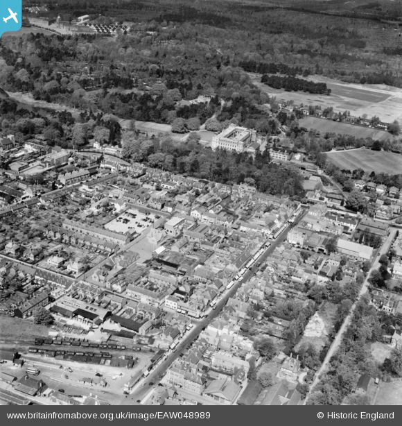
EAW048989 ENGLAND (1953). The High Street and town centre, Camberley, 1953
© Copyright OpenStreetMap contributors and licensed by the OpenStreetMap Foundation. 2025. Cartography is licensed as CC BY-SA.
Nearby Images (4)
EAW048989

EAW048986
, Camberley, from the north-east, 1953")
EAW048988

EAW048987
 and environs, Camberley, 1953")
Details
| Title | [EAW048989] The High Street and town centre, Camberley, 1953 |
| Reference | EAW048989 |
| Date | 5-May-1953 |
| Link | |
| Place name | CAMBERLEY |
| Parish | |
| District | |
| Country | ENGLAND |
| Easting / Northing | 487402, 160742 |
| Longitude / Latitude | -0.74512263067348, 51.338537844811 |
| National Grid Reference | SU874607 |
Pins
 CJC |
Sunday 9th of April 2023 10:52:47 PM | |
CJC |
Sunday 9th of April 2023 10:51:54 PM | |
The Laird |
Wednesday 27th of November 2019 08:44:48 PM | |
The Laird |
Wednesday 27th of November 2019 08:44:13 PM | |
David960 |
Saturday 31st of January 2015 05:08:57 PM |