
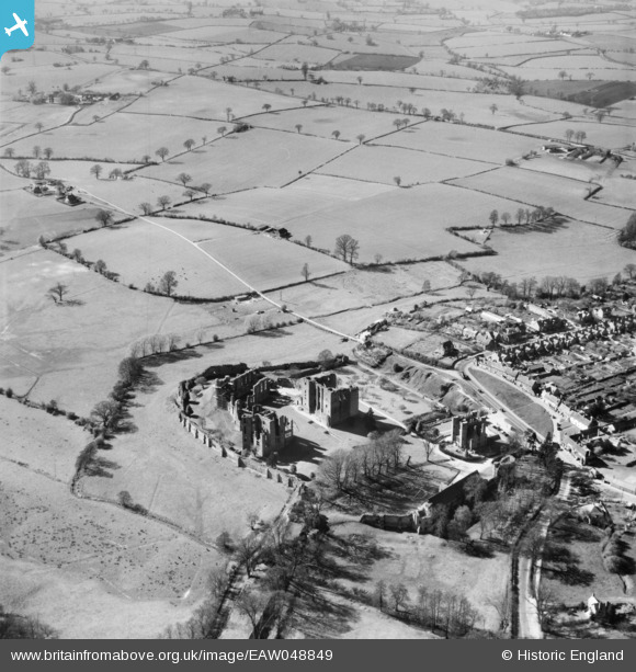
EAW048849 ENGLAND (1953). Kenilworth Castle, Kenilworth, 1953
© Copyright OpenStreetMap contributors and licensed by the OpenStreetMap Foundation. 2026. Cartography is licensed as CC BY-SA.
Nearby Images (24)
EAW048849

EAW025677

EAW007527

EAW048847

EAW007524

EAW001826

EAW001827

EAW006689

EAW006690

EAW007526

EPW015073

EPW001183

EPW015074

EAW007528

EAW007525

EAW048850

EAW007523

EAW007522

EAW003651

EAW007530

EAW006688

EAW007529

EAW025676

EAW003652

Details
| Title | [EAW048849] Kenilworth Castle, Kenilworth, 1953 |
| Reference | EAW048849 |
| Date | 23-April-1953 |
| Link | |
| Place name | KENILWORTH |
| Parish | KENILWORTH |
| District | |
| Country | ENGLAND |
| Easting / Northing | 427619, 272423 |
| Longitude / Latitude | -1.5944883611847, 52.348796225705 |
| National Grid Reference | SP276724 |
Pins
Be the first to add a comment to this image!