
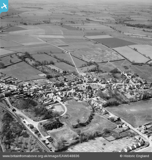
EAW048836 ENGLAND (1953). The town, Clare, 1953
© Copyright OpenStreetMap contributors and licensed by the OpenStreetMap Foundation. 2026. Cartography is licensed as CC BY-SA.
Nearby Images (5)
EAW048836

EAW048835

EAW024385

EAW024384

EAW024383

Details
| Title | [EAW048836] The town, Clare, 1953 |
| Reference | EAW048836 |
| Date | 23-April-1953 |
| Link | |
| Place name | CLARE |
| Parish | CLARE |
| District | |
| Country | ENGLAND |
| Easting / Northing | 576846, 245467 |
| Longitude / Latitude | 0.58102987762679, 52.078858202609 |
| National Grid Reference | TL768455 |
Pins

Pluvsj |
Wednesday 3rd of December 2025 03:09:16 PM | |
|
Pluvsj |
Wednesday 3rd of December 2025 03:08:06 PM | |
|
Pluvsj |
Wednesday 3rd of December 2025 03:06:30 PM | |
|
Pluvsj |
Wednesday 3rd of December 2025 03:05:10 PM | |
|
Pluvsj |
Wednesday 3rd of December 2025 03:04:22 PM | |
|
David960 |
Saturday 28th of February 2015 05:57:46 PM | |
|
David960 |
Saturday 28th of February 2015 05:57:15 PM | |
|
David960 |
Saturday 28th of February 2015 05:56:09 PM | |
|
MB |
Sunday 22nd of June 2014 11:58:04 AM | |
|
MB |
Sunday 22nd of June 2014 11:57:45 AM | |
|
MB |
Sunday 22nd of June 2014 11:57:18 AM | |
|
MB |
Sunday 22nd of June 2014 11:57:01 AM | |
|
MB |
Sunday 22nd of June 2014 11:54:34 AM | |
|
MB |
Sunday 22nd of June 2014 11:52:43 AM | |
|
MB |
Sunday 22nd of June 2014 11:51:55 AM | |
|
MB |
Sunday 22nd of June 2014 11:51:30 AM | |
|
MB |
Sunday 22nd of June 2014 11:51:06 AM | |
|
MB |
Sunday 22nd of June 2014 11:50:40 AM | |
|
MB |
Sunday 22nd of June 2014 11:50:05 AM | |
|
MB |
Sunday 22nd of June 2014 11:49:41 AM | |
|
MB |
Sunday 22nd of June 2014 11:47:08 AM | |
|
MB |
Sunday 22nd of June 2014 11:44:00 AM |