
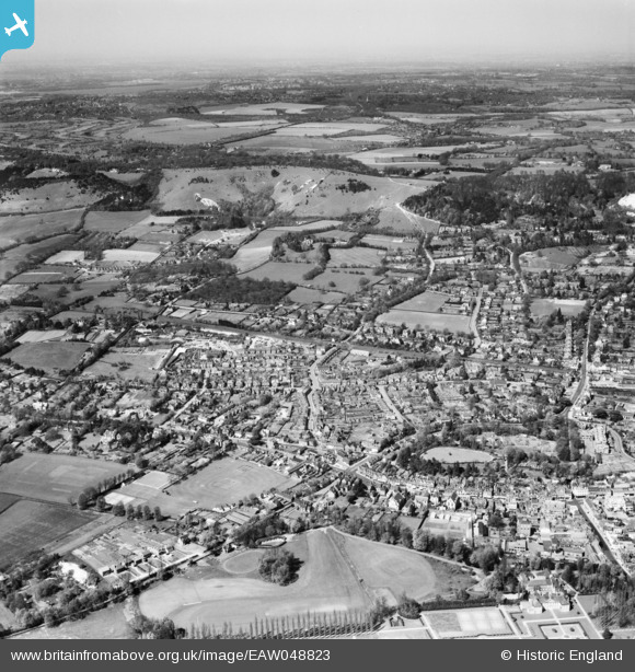
EAW048823 ENGLAND (1953). The town and Colley Hill, Reigate, from the south, 1953
© Copyright OpenStreetMap contributors and licensed by the OpenStreetMap Foundation. 2026. Cartography is licensed as CC BY-SA.
Nearby Images (4)
EAW048823

EAW008245

EAW048824

EAW008246

Details
| Title | [EAW048823] The town and Colley Hill, Reigate, from the south, 1953 |
| Reference | EAW048823 |
| Date | 26-April-1953 |
| Link | |
| Place name | REIGATE |
| Parish | |
| District | |
| Country | ENGLAND |
| Easting / Northing | 524981, 150241 |
| Longitude / Latitude | -0.20949713867335, 51.237130083597 |
| National Grid Reference | TQ250502 |
Pins
Be the first to add a comment to this image!