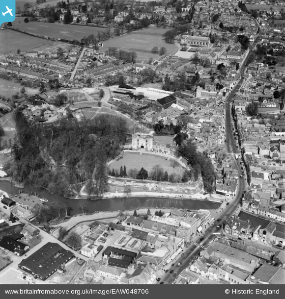
EAW048706 ENGLAND (1953). Tonbridge Castle, The Big Bridge and the town, Tonbridge, 1953
© Copyright OpenStreetMap contributors and licensed by the OpenStreetMap Foundation. 2025. Cartography is licensed as CC BY-SA.
Nearby Images (6)
Details
| Title | [EAW048706] Tonbridge Castle, The Big Bridge and the town, Tonbridge, 1953 |
| Reference | EAW048706 |
| Date | 8-April-1953 |
| Link | |
| Place name | TONBRIDGE |
| Parish | |
| District | |
| Country | ENGLAND |
| Easting / Northing | 558974, 146597 |
| Longitude / Latitude | 0.27550963718791, 51.195926702441 |
| National Grid Reference | TQ590466 |
Pins

Matt Aldred edob.mattaldred.com |
Friday 1st of January 2021 10:24:09 PM |


![[EAW048706] Tonbridge Castle, The Big Bridge and the town, Tonbridge, 1953](http://britainfromabove.org.uk/sites/all/libraries/aerofilms-images/public/100x100/EAW/048/EAW048706.jpg)
![[EAW048705] Tonbridge Castle, The Big Bridge and the town, Tonbridge, 1953](http://britainfromabove.org.uk/sites/all/libraries/aerofilms-images/public/100x100/EAW/048/EAW048705.jpg)
![[EAW048707] Tonbridge Castle and the town, Tonbridge, 1953](http://britainfromabove.org.uk/sites/all/libraries/aerofilms-images/public/100x100/EAW/048/EAW048707.jpg)
![[EAW048708] Tonbridge Castle and the town, Tonbridge, 1953](http://britainfromabove.org.uk/sites/all/libraries/aerofilms-images/public/100x100/EAW/048/EAW048708.jpg)
![[EPW060389] The Castle, the High Street and the town, Tonbridge, 1939](http://britainfromabove.org.uk/sites/all/libraries/aerofilms-images/public/100x100/EPW/060/EPW060389.jpg)
![[EPW062780] Meadow Lawn, Tonbridge, from the north-east, 1939](http://britainfromabove.org.uk/sites/all/libraries/aerofilms-images/public/100x100/EPW/062/EPW062780.jpg)