
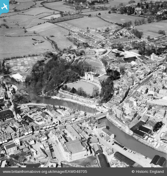
EAW048705 ENGLAND (1953). Tonbridge Castle, The Big Bridge and the town, Tonbridge, 1953
© Copyright OpenStreetMap contributors and licensed by the OpenStreetMap Foundation. 2026. Cartography is licensed as CC BY-SA.
Nearby Images (6)
EAW048705

EAW048706

EAW048708

EAW048707

EPW060389

EPW062780

Details
| Title | [EAW048705] Tonbridge Castle, The Big Bridge and the town, Tonbridge, 1953 |
| Reference | EAW048705 |
| Date | 8-April-1953 |
| Link | |
| Place name | TONBRIDGE |
| Parish | |
| District | |
| Country | ENGLAND |
| Easting / Northing | 558966, 146579 |
| Longitude / Latitude | 0.27538725309149, 51.195767182658 |
| National Grid Reference | TQ590466 |
Pins

Matt Aldred edob.mattaldred.com |
Friday 1st of January 2021 10:28:18 PM | |
|
Matt Aldred edob.mattaldred.com |
Friday 1st of January 2021 10:26:14 PM | |

JimmyBrandon |
Sunday 25th of September 2016 04:29:26 PM |