
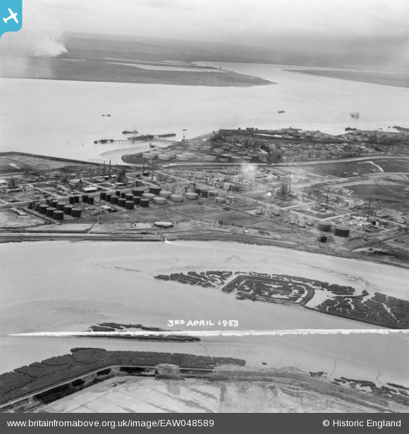
EAW048589 ENGLAND (1953). Upper Horse and the Coryton Oil Refinery under construction, Canvey Island, from the north-east, 1953. This image was marked by Aerofilms Ltd for photo editing.
© Copyright OpenStreetMap contributors and licensed by the OpenStreetMap Foundation. 2026. Cartography is licensed as CC BY-SA.
Nearby Images (4)
EAW048589

EAW041997

EAW051377

EAW034443

Details
| Title | [EAW048589] Upper Horse and the Coryton Oil Refinery under construction, Canvey Island, from the north-east, 1953. This image was marked by Aerofilms Ltd for photo editing. |
| Reference | EAW048589 |
| Date | 3-April-1953 |
| Link | |
| Place name | CANVEY ISLAND |
| Parish | CANVEY ISLAND |
| District | |
| Country | ENGLAND |
| Easting / Northing | 575257, 182850 |
| Longitude / Latitude | 0.52621221460728, 51.516862892982 |
| National Grid Reference | TQ753829 |
Pins
Be the first to add a comment to this image!