
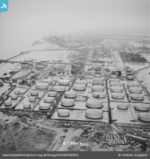
EAW048364 ENGLAND (1953). Flooding at the Coryton Oil Refinery, Coryton, from the north-east, 1953. This image was marked by Aerofilms Ltd for photo editing.
© Copyright OpenStreetMap contributors and licensed by the OpenStreetMap Foundation. 2026. Cartography is licensed as CC BY-SA.
Nearby Images (10)
EAW048364

EAW048362

EPW045635

EPW045634

EAW048365

EAW043891

EAW047428

EPW044782

EPW044787

EAW047432

Details
| Title | [EAW048364] Flooding at the Coryton Oil Refinery, Coryton, from the north-east, 1953. This image was marked by Aerofilms Ltd for photo editing. |
| Reference | EAW048364 |
| Date | 3-February-1953 |
| Link | |
| Place name | CORYTON |
| Parish | |
| District | |
| Country | ENGLAND |
| Easting / Northing | 576030, 182312 |
| Longitude / Latitude | 0.53707408026506, 51.511789321141 |
| National Grid Reference | TQ760823 |
Pins
Be the first to add a comment to this image!