
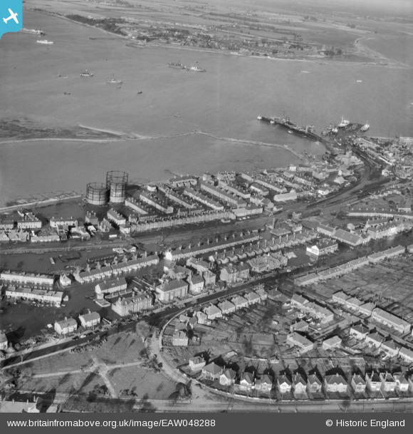
EAW048288 ENGLAND (1953). Flooding at Bath Side, Harwich, 1953
© Copyright OpenStreetMap contributors and licensed by the OpenStreetMap Foundation. 2026. Cartography is licensed as CC BY-SA.
Nearby Images (7)
EAW048288

EAW048285

EAW048286

EAW025898

EAW025899

EAW048284

EAW048287

Details
| Title | [EAW048288] Flooding at Bath Side, Harwich, 1953 |
| Reference | EAW048288 |
| Date | 2-February-1953 |
| Link | |
| Place name | HARWICH |
| Parish | HARWICH |
| District | |
| Country | ENGLAND |
| Easting / Northing | 625870, 232201 |
| Longitude / Latitude | 1.2866401516072, 51.941948181297 |
| National Grid Reference | TM259322 |
Pins

Sparky |
Thursday 26th of October 2017 12:53:31 AM | |
|
Sparky |
Thursday 26th of October 2017 12:52:49 AM | |

Brightonboy |
Wednesday 17th of February 2016 08:17:42 AM | |
|
Brightonboy |
Wednesday 17th of February 2016 08:09:25 AM | |
|
Brightonboy |
Wednesday 17th of February 2016 08:07:28 AM | |
|
Brightonboy |
Wednesday 17th of February 2016 08:03:36 AM | |
|
Brightonboy |
Wednesday 17th of February 2016 08:00:54 AM | |
TSS 'Essex Ferry' of 1917 |
mannidaze |
Sunday 27th of January 2019 03:47:32 PM |
|
Brightonboy |
Wednesday 17th of February 2016 08:00:49 AM | |
|
Al |
Wednesday 17th of February 2016 12:39:22 AM | |
|
Al |
Wednesday 17th of February 2016 12:39:19 AM | |

Billy Turner |
Friday 12th of February 2016 08:44:54 PM | |
|
Billy Turner |
Friday 12th of February 2016 08:24:44 PM |

