
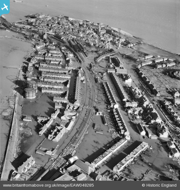
EAW048285 ENGLAND (1953). Flooding at Bath Side, Harwich, 1953
© Copyright OpenStreetMap contributors and licensed by the OpenStreetMap Foundation. 2026. Cartography is licensed as CC BY-SA.
Nearby Images (7)
EAW048285

EAW048288

EAW048286

EAW025899

EAW048284

EPW039290

EAW025898

Details
| Title | [EAW048285] Flooding at Bath Side, Harwich, 1953 |
| Reference | EAW048285 |
| Date | 2-February-1953 |
| Link | |
| Place name | HARWICH |
| Parish | HARWICH |
| District | |
| Country | ENGLAND |
| Easting / Northing | 625908, 232141 |
| Longitude / Latitude | 1.287152695006, 51.941394134227 |
| National Grid Reference | TM259321 |
Pins

Matt Aldred edob.mattaldred.com |
Monday 8th of March 2021 12:04:46 PM | |
|
Matt Aldred edob.mattaldred.com |
Monday 8th of March 2021 12:04:33 PM | |

Billy Turner |
Friday 12th of February 2016 08:57:52 PM | |

jrussill |
Monday 2nd of February 2015 04:49:44 PM | |
|
jrussill |
Monday 2nd of February 2015 04:49:03 PM | |
|
Briarwood |
Thursday 23rd of October 2014 10:52:11 PM |

User Comment Contributions

WW2 Pillboxes |
jrussill |
Monday 2nd of February 2015 04:50:32 PM |