
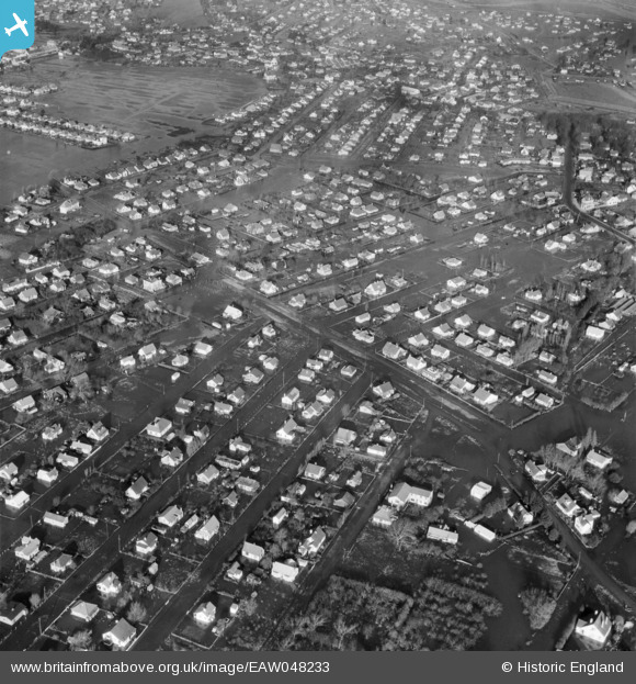
EAW048233 ENGLAND (1953). Flooded housing around Crescent Road, Canvey Island, 1953
© Copyright OpenStreetMap contributors and licensed by the OpenStreetMap Foundation. 2025. Cartography is licensed as CC BY-SA.
Nearby Images (2)
EAW048233

EAW026920

Details
| Title | [EAW048233] Flooded housing around Crescent Road, Canvey Island, 1953 |
| Reference | EAW048233 |
| Date | 2-February-1953 |
| Link | |
| Place name | CANVEY ISLAND |
| Parish | CANVEY ISLAND |
| District | |
| Country | ENGLAND |
| Easting / Northing | 580803, 183025 |
| Longitude / Latitude | 0.6061562723772, 51.516687062062 |
| National Grid Reference | TQ808830 |
Pins

garibaldi52 |
Thursday 23rd of January 2020 12:08:58 AM |