
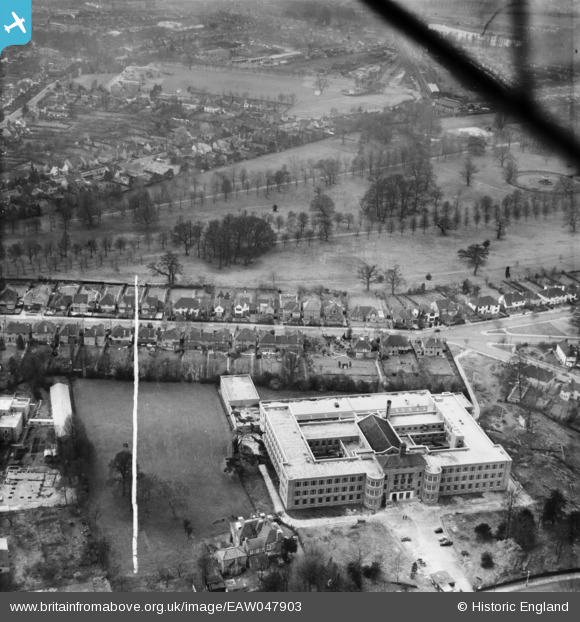
EAW047903 ENGLAND (1952). Watford Technical College and Cassiobury Park, Watford, 1952. This image was marked by Aerofilms Ltd for photo editing.
© Copyright OpenStreetMap contributors and licensed by the OpenStreetMap Foundation. 2026. Cartography is licensed as CC BY-SA.
Nearby Images (5)
EAW047903

EAW026498

EPW039631

EPW019234

EAW047902

Details
| Title | [EAW047903] Watford Technical College and Cassiobury Park, Watford, 1952. This image was marked by Aerofilms Ltd for photo editing. |
| Reference | EAW047903 |
| Date | 17-November-1952 |
| Link | |
| Place name | WATFORD |
| Parish | |
| District | |
| Country | ENGLAND |
| Easting / Northing | 510145, 196819 |
| Longitude / Latitude | -0.40744460030853, 51.658884004884 |
| National Grid Reference | TQ101968 |
