
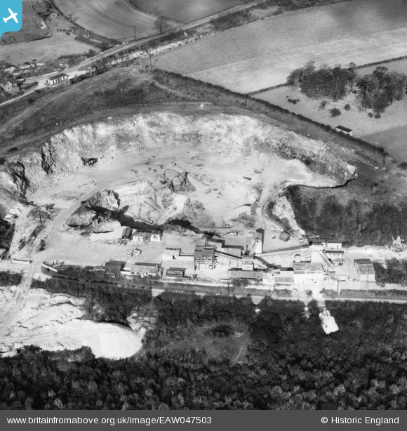
EAW047503 ENGLAND (1952). Sprotbrough Quarries, Sprotbrough, 1952
© Copyright OpenStreetMap contributors and licensed by the OpenStreetMap Foundation. 2026. Cartography is licensed as CC BY-SA.
Nearby Images (25)
EAW047503

EAW047501

EAW047500

EAW049687

EAW043513

EAW047498

EAW043516

EAW043517

EAW043514

EAW047499

EAW049691

EAW043518

EAW047504

EAW047502

EAW047505

EAW043512

EAW049692

EAW043515

EAW043526

EAW049686

EAW043521

EAW043525

EAW043523

EAW043524

EAW043522

Details
| Title | [EAW047503] Sprotbrough Quarries, Sprotbrough, 1952 |
| Reference | EAW047503 |
| Date | 10-October-1952 |
| Link | |
| Place name | SPROTBROUGH |
| Parish | SPROTBROUGH AND CUSWORTH |
| District | |
| Country | ENGLAND |
| Easting / Northing | 453367, 401501 |
| Longitude / Latitude | -1.195240053528, 53.507236509408 |
| National Grid Reference | SE534015 |
Pins

MB |
Sunday 13th of July 2014 10:06:45 AM | |
|
MB |
Sunday 13th of July 2014 10:02:31 AM | |
|
MB |
Sunday 13th of July 2014 09:58:51 AM |