
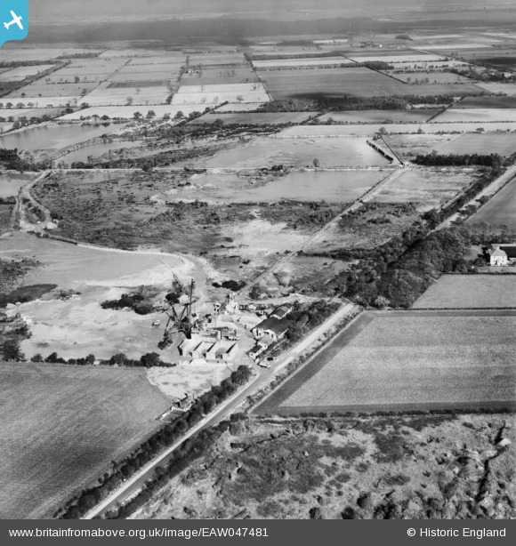
EAW047481 ENGLAND (1952). Quarry on Wroot Road and environs, Blaxton, from the south, 1952
© Copyright OpenStreetMap contributors and licensed by the OpenStreetMap Foundation. 2025. Cartography is licensed as CC BY-SA.
Nearby Images (13)
EAW047481

EAW047484

EAW047488

EAW043520

EAW043519

EAW047483

EAW047486

EAW047487

EAW047485

EAW043528

EAW047480

EAW043531

EAW047476

Details
| Title | [EAW047481] Quarry on Wroot Road and environs, Blaxton, from the south, 1952 |
| Reference | EAW047481 |
| Date | 10-October-1952 |
| Link | |
| Place name | BLAXTON |
| Parish | FINNINGLEY |
| District | |
| Country | ENGLAND |
| Easting / Northing | 468741, 400662 |
| Longitude / Latitude | -0.96362523463717, 53.497910364091 |
| National Grid Reference | SE687007 |
Pins
Be the first to add a comment to this image!