
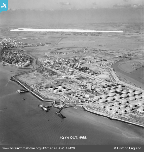
EAW047429 ENGLAND (1952). Coryton Oil Refinery and environs, Coryton, from the south-east, 1952. This image was marked by Aerofilms Ltd for photo editing.
© Copyright OpenStreetMap contributors and licensed by the OpenStreetMap Foundation. 2026. Cartography is licensed as CC BY-SA.
Nearby Images (9)
EAW047429

EAW048361

EAW048366

EAW047428

EPW044787

EPW044782

EAW043891

EAW048300

EAW048360

Details
| Title | [EAW047429] Coryton Oil Refinery and environs, Coryton, from the south-east, 1952. This image was marked by Aerofilms Ltd for photo editing. |
| Reference | EAW047429 |
| Date | 10-October-1952 |
| Link | |
| Place name | CORYTON |
| Parish | |
| District | |
| Country | ENGLAND |
| Easting / Northing | 575889, 181995 |
| Longitude / Latitude | 0.5348858723881, 51.50898540855 |
| National Grid Reference | TQ759820 |
Pins
Be the first to add a comment to this image!