
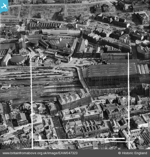
EAW047323 ENGLAND (1952). Forster Square Railway Station, Bradford, 1952. This image was marked by Aerofilms Ltd for photo editing.
© Copyright OpenStreetMap contributors and licensed by the OpenStreetMap Foundation. 2026. Cartography is licensed as CC BY-SA.
Nearby Images (15)
EAW047323

EAW047325

EAW047326

EAW047324

EAW049790

EAW049785

EAW049787

EAW049783

EPW054317

EAW049788

EAW049789

EAW049786

EAW049784

EPW024394

EPW054323

Details
| Title | [EAW047323] Forster Square Railway Station, Bradford, 1952. This image was marked by Aerofilms Ltd for photo editing. |
| Reference | EAW047323 |
| Date | 17-September-1952 |
| Link | |
| Place name | BRADFORD |
| Parish | |
| District | |
| Country | ENGLAND |
| Easting / Northing | 416462, 433492 |
| Longitude / Latitude | -1.7500501713552, 53.797259152657 |
| National Grid Reference | SE165335 |
Pins

John N |
Saturday 24th of October 2020 12:41:44 AM |