
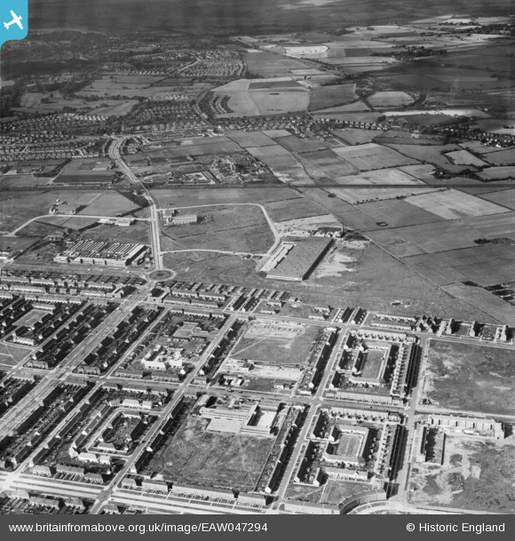
EAW047294 ENGLAND (1952). Part of the Speke Industrial Estate and the residential area surrounding Stapleton Avenue, Speke, 1952
© Copyright OpenStreetMap contributors and licensed by the OpenStreetMap Foundation. 2026. Cartography is licensed as CC BY-SA.
Nearby Images (8)
EAW047294

EAW047295

EPW057871

EAW003054

EAW003052

EAW003055

EAW003056

EAW047298

Details
| Title | [EAW047294] Part of the Speke Industrial Estate and the residential area surrounding Stapleton Avenue, Speke, 1952 |
| Reference | EAW047294 |
| Date | 4-October-1952 |
| Link | |
| Place name | SPEKE |
| Parish | |
| District | |
| Country | ENGLAND |
| Easting / Northing | 343734, 383932 |
| Longitude / Latitude | -2.8453319192297, 53.349013767163 |
| National Grid Reference | SJ437839 |
Pins

Hamilton163 |
Sunday 11th of September 2022 10:38:32 AM | |
|
Hamilton163 |
Sunday 15th of March 2015 09:15:49 PM | |
|
Hamilton163 |
Sunday 15th of March 2015 09:15:26 PM | |
|
Hamilton163 |
Sunday 15th of March 2015 09:14:49 PM | |
|
Hamilton163 |
Sunday 15th of March 2015 09:13:51 PM |