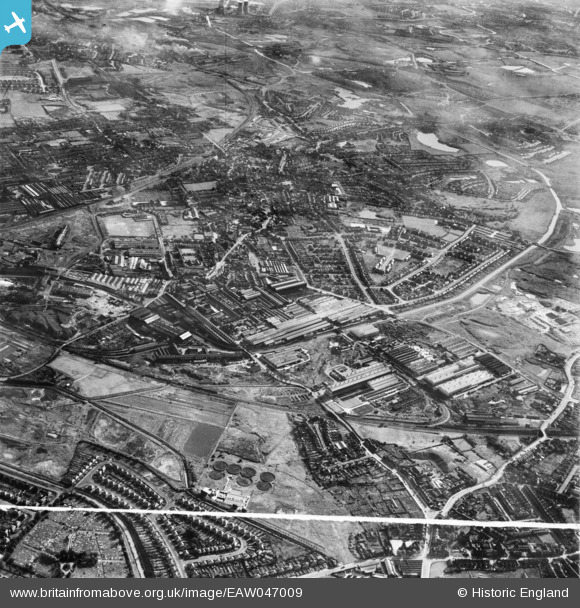
EAW047009 ENGLAND (1952). The Rubery, Owen and Co Iron Works and environs, Darlaston, 1952. This image was marked by Aerofilms Ltd for photo editing.
© Copyright OpenStreetMap contributors and licensed by the OpenStreetMap Foundation. 2025. Cartography is licensed as CC BY-SA.
Nearby Images (6)
Details
| Title | [EAW047009] The Rubery, Owen and Co Iron Works and environs, Darlaston, 1952. This image was marked by Aerofilms Ltd for photo editing. |
| Reference | EAW047009 |
| Date | 23-September-1952 |
| Link | |
| Place name | DARLASTON |
| Parish | |
| District | |
| Country | ENGLAND |
| Easting / Northing | 397575, 297632 |
| Longitude / Latitude | -2.0357884900231, 52.576141558552 |
| National Grid Reference | SO976976 |
Pins
 KevTheBusDriver |
Sunday 28th of June 2015 09:23:33 PM | |
 KevTheBusDriver |
Sunday 28th of June 2015 09:22:42 PM | |
 KevTheBusDriver |
Sunday 28th of June 2015 09:20:59 PM |


![[EAW047009] The Rubery, Owen and Co Iron Works and environs, Darlaston, 1952. This image was marked by Aerofilms Ltd for photo editing.](http://britainfromabove.org.uk/sites/all/libraries/aerofilms-images/public/100x100/EAW/047/EAW047009.jpg)
![[EAW000764] The Rubery, Owen & Co Ltd Works, Darlaston, 1946](http://britainfromabove.org.uk/sites/all/libraries/aerofilms-images/public/100x100/EAW/000/EAW000764.jpg)
![[EAW047010] The Rubery, Owen and Co Iron Works and environs, Darlaston, 1952. This image was marked by Aerofilms Ltd for photo editing.](http://britainfromabove.org.uk/sites/all/libraries/aerofilms-images/public/100x100/EAW/047/EAW047010.jpg)
![[EAW047008] The Rubery, Owen and Co Iron Works and environs, Darlaston, 1952. This image was marked by Aerofilms Ltd for photo editing.](http://britainfromabove.org.uk/sites/all/libraries/aerofilms-images/public/100x100/EAW/047/EAW047008.jpg)
![[EAW000766] The Rubery, Owen & Co Ltd Works, Willenhall, 1946](http://britainfromabove.org.uk/sites/all/libraries/aerofilms-images/public/100x100/EAW/000/EAW000766.jpg)
![[EAW000768] The Rubery, Owen & Co Ltd Works, Willenhall, 1946](http://britainfromabove.org.uk/sites/all/libraries/aerofilms-images/public/100x100/EAW/000/EAW000768.jpg)