
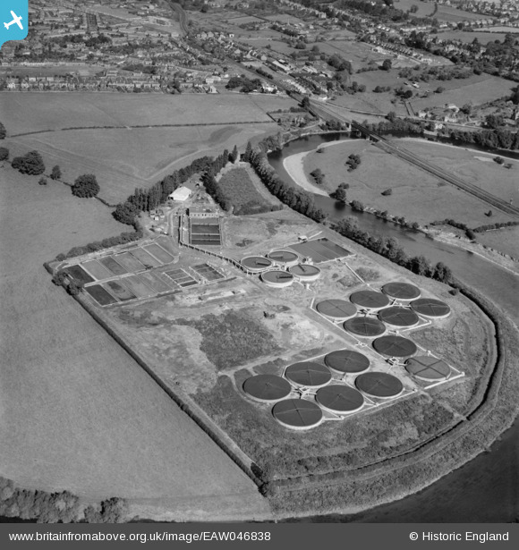
EAW046838 ENGLAND (1952). The Hereford Sewage Works alongside the River Wye, Hereford, 1952
© Copyright OpenStreetMap contributors and licensed by the OpenStreetMap Foundation. 2026. Cartography is licensed as CC BY-SA.
Nearby Images (11)
EAW046838

EAW046845

EAW046840

EAW046842

EAW046836

EAW046837

EAW046844

EAW046843

EAW046841

EAW046839

EAW046835

Details
| Title | [EAW046838] The Hereford Sewage Works alongside the River Wye, Hereford, 1952 |
| Reference | EAW046838 |
| Date | 18-September-1952 |
| Link | |
| Place name | HEREFORD |
| Parish | HEREFORD |
| District | |
| Country | ENGLAND |
| Easting / Northing | 352061, 238743 |
| Longitude / Latitude | -2.6990707821032, 52.044586875017 |
| National Grid Reference | SO521387 |
Pins
Be the first to add a comment to this image!